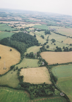
The light, sandy soils of Archenfield, in which Hentland is located, has been farmed for millenia, and the area was extensively settled by the time the Romans arrived. There are no 'Roman' roads here, in the classic sense of straight roads built by the army. But of course there were roads before the Romans arrived, and these continued to be used through the Romano-British period and beyond, probably mainly for packhorses rather than long distance wheeled traffic. These are often preserved as footpaths and greenways, and five of these meet at Hentland. Now there is only one road to Hentland, running in from the north, and the River Wye.
In the 17th century, the landscape of the area was considered strange and wild. In October 1646 the new Parliamentarian Governor of Hereford, Colonel John Birch, had ridden out to St Owen's Cross, in the “remote and little traversed district of Archenfield, a wild region resembling La Vendée, full of small enclosures parted out by the ancient custom of gavelkind, and divided by wide, tall, untrimmed fences, a region of copses and thickets and winding streams and deep and exceedingly narrow trackways, overgrown with briers above, and here and there worn beneath into rude steps and staircases of rock, where old houses with older names afforded ready hiding-places for the fugitive and the outlaw; - a retired and picturesque land; but dangerous in unquiet times.”
Birch had been made Governor of Hereford following his surprise capture of the city the previous December.
the road to Hentland |
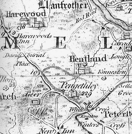
Isaac Taylor's 1754 map of Herefordshire shows Hentland church just outside the fence around Pengethley Park, the park attached to Pengethley House. The park has left a clear impression on the landscape between the church and the main A49 road. A double rectangle marks Gaer Cop Geer Copp. Red Rail Ford across the Wye is at the top of the map. |
|
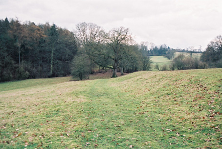
The old road pictured ran from Hentland Church towards St Owen's Cross and, ultimately, Monmouth. Monmouth was Castell Mingui in the mid 11th century when its church was one of those disputed between the Bishop of Llandaff and the Bishop of Hereford. |
|
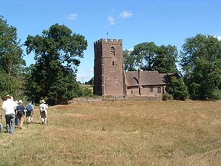
Looking in the opposit direction from the image above, the road from St Owen's Cross and Monmouth approaches Hentland. Despite restoration by Seddon in the 1850s this would by much the view that greeted travellers in the 14th Century, when the tower was added. A church has stood on this site for at least a thousand years. |
|
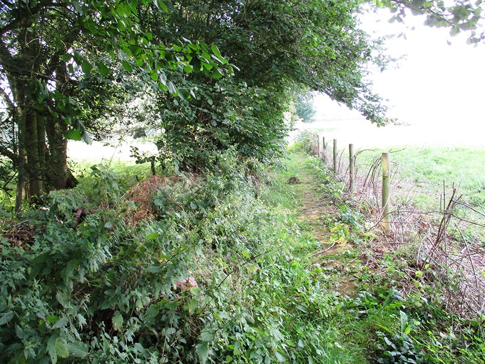
Immediately to the South of Hentland Church an old road leads off to Gillow. The holloway is much overgrown but the actual right of way is running above and is termed a 'dry weather path'. This is usually kept clear. |