|
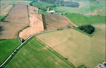
The ploughed-out Gaer Cop Iron Age hillfort in Hentland parish. There are not many hills in the area, and this one is quite low. The ditch is visible as a darker green against the lighter green of the rest of the crop in the two fields in the foreground. A lighter mark beyond indicates the position of the internal bank. The bank has dictated the course of the old lane running into the distance. The larger road is a turnpike newly built in the 1820s which cut through the then standing ramparts of the hillfort and ensured its almost total destruction. |
|
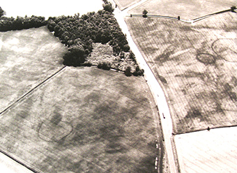
Cropmarks beside the A49 road as it passes through Hentland Parish. Gaer Cop is just out of the picture to the top right. This is a very busy multi-period landscape the complexity of which is only visible as cropmarks at the right time of year. This land has been intensively utilised for millennia |
|
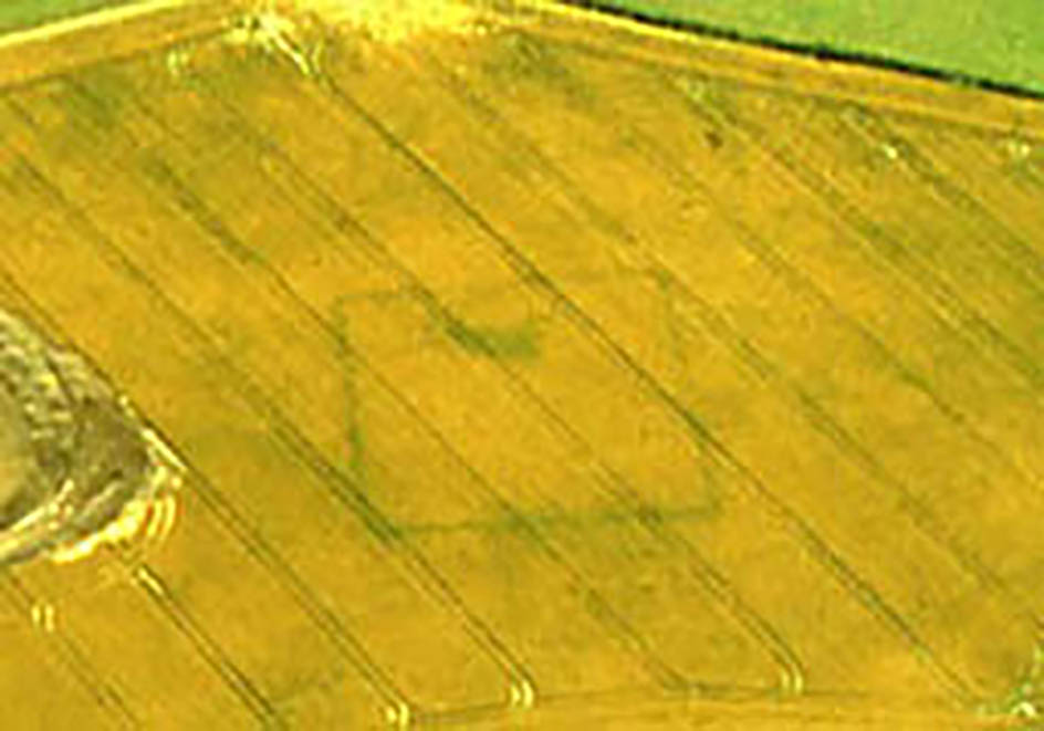
A rectangular feature shown as a cropmark in the southern part of the parish. This site has never been investigated but its regularity suggest a Roman date, the sort of thing that the Roman army might have constructed. |